eLTER Tests its Prototype Cookie-cutting Tool for Exploring and Collating Data
We are continuing to develop an eLTER cookie-cutting tool, designed to make it easy to explore and collateharmonised datasets for a spatial unit like an eLTER site. Extracting data that are relevant for a site now takes a minute instead of potentially hours. This is one of the first steps towards establishing “information clusters” for each site benefiting from multiple data sources beyond data gathered at the site.
The prototype eLTER cookie-cutting tool is being tested after it was demonstrated to the eLTER PLUS community at the Mercury meeting in October 2020. It supports analyses across disciplines and domains and is used at the interface of several work packages within the eLTER PLUS project. If this proves useful it may be further developed into a permanent service for the eLTER RI.
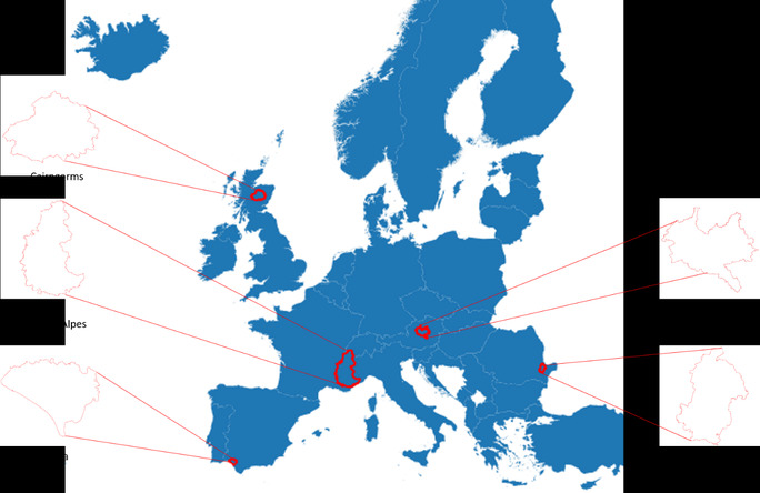
In eLTER PLUS five LTSER platforms are piloting the tool (Fig 1).

Figure 1
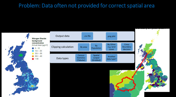
The problem that the eLTER cookie-cutting tool addresses is that relevant data come from various sources and is often not provided for the correct spatial area required (Fig 2).
The current version is hosted in the datalabs platform and delivers data processing workflows for gridded (raster) and non-gridded (tabular) data. It has the five pilot LTSER platforms’ boundaries preloaded.

Figure 2
To use the tool, users browse through the central repository, set filters and select how they want to extract their site-specific data. The resulting dataset is then available with added spatial information for further processing.A preview is also displayed to allow for a visual check of the resulting dataset. The tool is being developed according to the wishes of the research community.Development and documentation efforts are ongoing as of March 2021, currently various datasets are being uploaded to test the functionality of the “cookie-cutter”.
Jan Dick, Will Bolton and John Watkins (UK CEH)