Measuring and upscaling soil moisture with Drones
Author: Ricardo Díaz-Delgado (CSIC, Spain)
Location: Brittany, France
Research stay dates: 22/07/2023-09/08/2023
My TA proposal named “Upsacaling of WAter Stress in AgroHydroSystems (UWASA)” was accepted in April 2023 and I agreed with Ophelie Fovet (UMR SAS-INRAE, France) on my stay dates. We chose summer to be able to track enough soil moisture variability in such a humid region. I had the fantastic chance to visit the eLTER site OZCAR-RI AgrHyS Environmental Research Observatory Site of Kervidy-Naizin, located in central Brittany, France. Our plan was to address the upscaling of soil moisture with drone and satellite images for this site using in-situ measurements for model building and validation. Before my arrival, we carried out several online meetings in which I decided to bring our mobile Cosmic-Ray Neutron Sensor (rover) in order to enhance the in-situ measurements. I also brought my ©Spectralon 99% calibration panel to assess irradiance and reflectance calculation. Everything was superbly arranged and prepared with the help of Ophelie, who also organised a previous online meeting with other researchers which will later help us with the sampling campaign and the requested flight permits for drones in the area. Among them, Thomas Houet’s team from Unité mixte de recherche: Littoral - Environnement - Télédétection – Géomatique (UMR:LETG) CNRS Rennes, who will be providing their help with their splendid equipment and drones so I did not have to bring my own one. Thomas suggested enlarging our sampling to the Sougeal marshes located South of Pontorson town. This area is a protected wetland and belongs to the LTSER Zone Atelier Armorique. These marshes offer a higher variation of soil moisture, although they are 150 km away from Naizin. On the first day, we were happy to have a kind and sunny weather very suitable for drone flights with multispectral cameras, although clouds were peacefully conquering the sky and finally the rain. We were very lucky to have the assistance of Ophelie (by that moment pregnant), Mikael Faucheux, Yannick Hamon and Pauline Buysse from INRAE as well, Thomas and the excellent drones’ pilot, Thibaut Peres, both from UMR:LETG of CRNS. The CRNS team made several flights over both sites with fixed-wing and multirotor drones enabling to retrieve multispectral images from MicaSense RedEdge MX camera, thermal images from AgEagle Duet-T camera and RGB and point cloud from Zenmuse L1 Lidar. In-situ sampling consisted of point soil moisture measurements with Theta Probe across linear transects, extensive sampling with portable CRNS transported with the help of a quad, geolocation with GNSS and spectroradiometric measurements with a ASD FieldSpec FR. 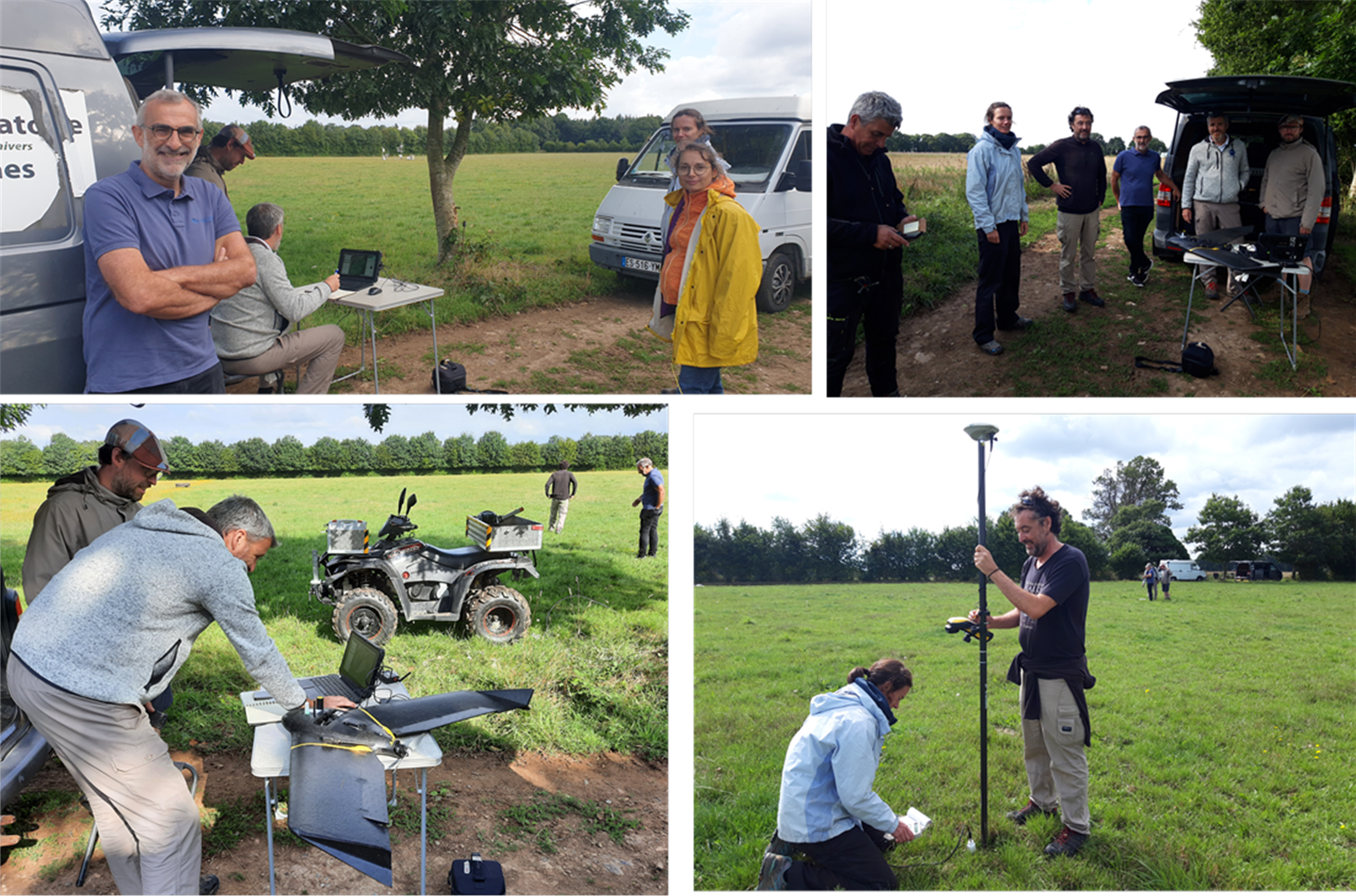
Picture 1. Different shots of the staff involved in my stay. Top left image from left to right: Mikael, Thibaut and Thomas planning drone mission and Pauline and Ophelie. Right left image from left to right: Yannick, Pauline, Ricardo, Mikael, Thomas and Thibaut. Bottom left image: detail on the quad we used to measure with the mobile CRNS. Bottom right image: Pauline and Ricardo, measuring point soil moisture with Theta Probe and precise location of sampling with Trimble Geo 7X.
During flights, INRAE sampled point soil moisture with the Tetha probe and with my CRNS onboard of a quad. Unfortunately after collecting more than 1000 points with the CRNS rover, we confirmed that it was not properly functioning likely due to shipping issues. Therefore, for Sougeal we planned more point samples with the Theta Probe.
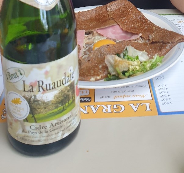
Picture 2. From the very first day, we could try the exquisite Galette Bretonne and the refreshing Bretonne cider.
Data is still being analysed to assess different soil moisture retrieval methods using remote sensing data. Thomas and Thibaut were in charge of processing the huge amount of images and data collected by drones, providing highly valuable and accurate orthomosaics of multispectral bands reflectance, of surface temperature and digital elevation models for the overflown areas. They also provided precise positioning of all measurements.
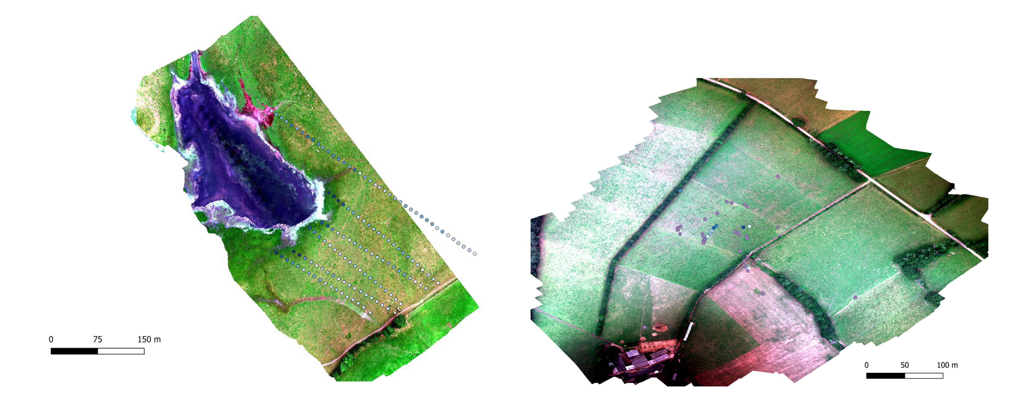
Picture 3. Multispectral orthomosaics for Sougeal (left) and Naizin (right). The RGB composition uses NIR, RedEdge and Red bands with the location of sampling points on top of them.
We, my wife, daughter and me, had a fantastic stay in French Brittany although a bit wet. I am very grateful to Ophelie and the other colleagues for their help, assistance and kindness.